no one quite knows where aid ends up or what it's used for
it sounds ridiculous.
but USAID gave us $25m to investigate
who provides aid, to whom, where, when, for what?
how we achieve our goal: geocoding and activity coding
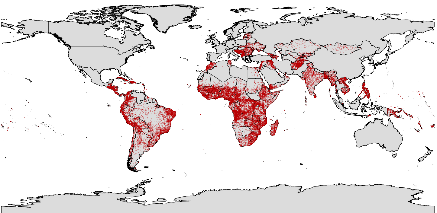
geocoding
where? (pulling from >8m place names)
activity coding
what? ( 544 descriptive codes in use)
activity codes include . . .
21040.02: "harbor guidance systems"
31150.03: "Supply of fertilizers"
16010.10: "Social mitigation of HIV/AIDS"
sources vary
"Creditor Reporting System"
~2.3m records from 1979 - 2011
"International Aid Transparency Initiative"
donor contributed records
"Aid Management Platform" country by country databases of aid received
World Bank alone has 156 document types
DAC members ( official donors club )
example inputs
DOC/DOCX
spreadsheets
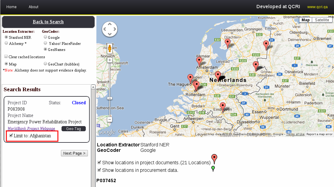
auto geocoding attempts
afghanistan?


AidData China has user contributed photos of Chinese projects in Africa
contact
adecatur@aiddata.org (me) sstewart@aiddata.org